Demonstrated Accuracy
The following projects demonstrate our data collection and processing capabilities. Survey control and aerial targets for these projects set by BSN Santa Fe.
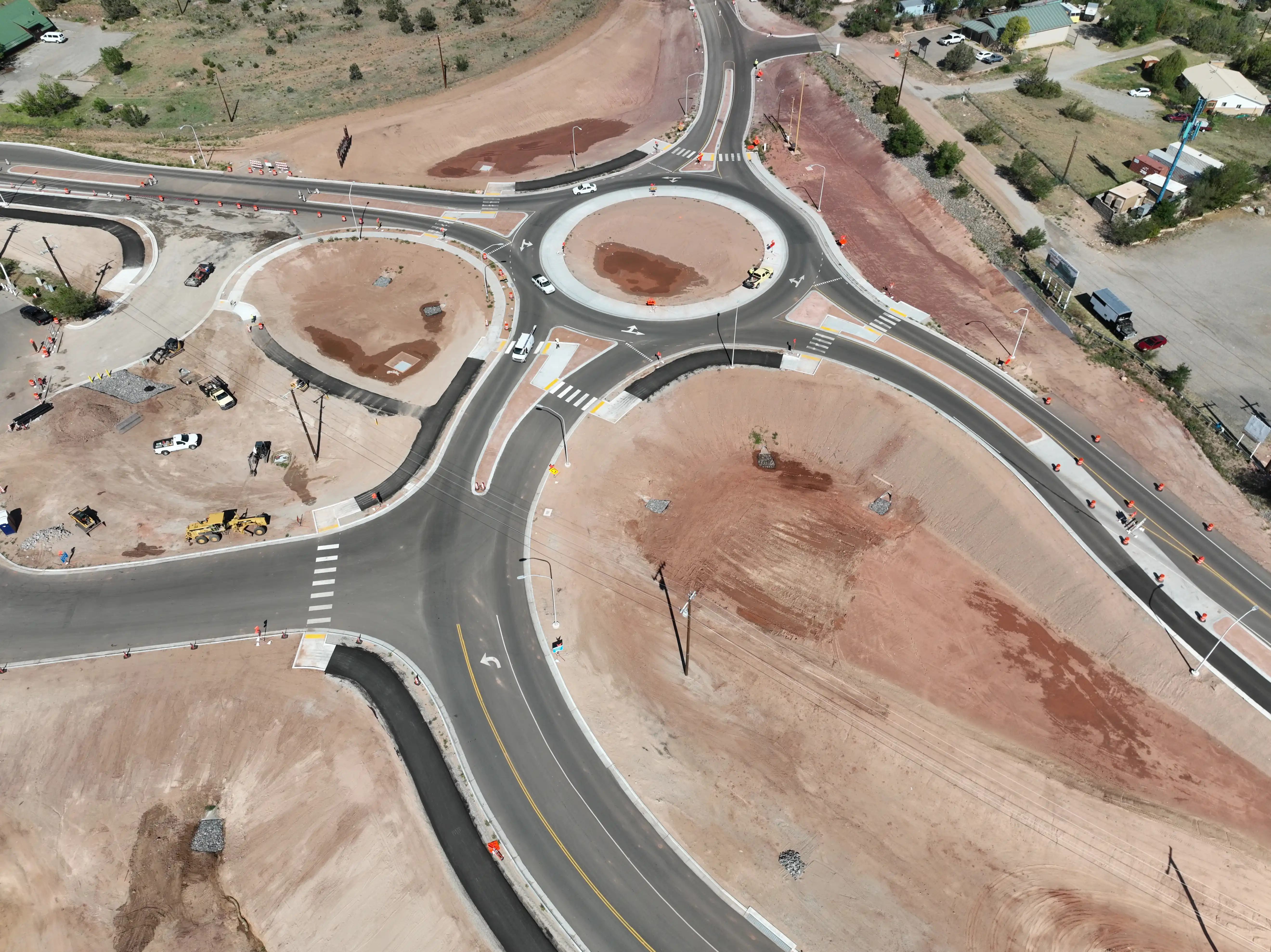
Example 1
Location: Sandia Crest, New Mexico | Date: September 2025
Component RMSE: X=0.063 ft, Y=0.069 ft, Z=0.189 ft
GCPs: 8 points
Checkpoints: 7 points | RMSE: 0.211 ft (6.4 cm)
Project Specifications
- GSD: 0.079 ft (2.4 cm/pixel)
- Images Processed: 334
- Drone: DJI M3E
- Coordinate System: NAD83 / New Mexico Central (ftUS) + NAVD88 height (ftUS)
Example 2
Location: Corona, New Mexico | Date: September 26, 2025
Component RMSE: X=0.078 ft, Y=0.058 ft, Z=0.287 ft
GCPs: 42 points
Checkpoints: 10 points | RMSE: 0.302 ft (9.2 cm)
Project Specifications
- GSD: 0.088 ft (2.7 cm/pixel)
- Corridor Length: 5 Miles
- Images Processed: 1,304
- Drone: DJI M3E
- Coordinate System: NAD83 / New Mexico Central (ftUS) + NAVD88 height (ftUS)
Example 3
Location: Tres Piedras, New Mexico | Date: October 8, 2025
Component RMSE: X=0.061 ft, Y=0.073 ft, Z=0.315 ft
GCPs: 71 points
Checkpoints: 17 points | RMSE: 0.329 ft (10.0 cm)
Project Specifications
- GSD: 0.087 ft (2.7 cm/pixel)
- Corridor Length: 6.5 Miles
- Images Processed: 1,658
- Drone: DJI M3E
- Coordinate System: NAD83 / New Mexico Central (ftUS) + NAVD88 height (ftUS)
Example 4 (RTK-Only)
Location: Sandia Crest, New Mexico | Date: September 2025
Component RMSE: X=0.142 ft, Y=0.688 ft, Z=0.227 ft
Method: RTK-Only (No GCPs)
Checkpoints: 11 points* | RMSE: 0.738 ft (22.5 cm)
Note: RTK-only processing is suitable for shorter baselines and projects where sub-0.1 ft accuracy is not required. It provides a cost-effective solution for smaller projects.
*Additional checkpoints (compared to example 1) set by Stratus Imaging using control from BSN Santa Fe.
Project Specifications
- GSD: 0.079 ft (2.4 cm/pixel)
- Images Processed: 334
- Drone: DJI M3E
- Coordinate System: NAD83 / New Mexico Central (ftUS) + NAVD88 height (ftUS)