When you're considering drone mapping services, one of the key factors influencing both the resolution (or level of detail) of the final map and the cost of the service is Ground Sampling Distance (GSD). But what exactly is GSD, and why should you care about it when planning your project? Let's break it down.
What is GSD?
GSD is the real-world size that one pixel in your drone image represents. It describes how much ground each pixel covers in inches or centimeters. Think about it this way, the smaller the GSD, the more detail your image will contain. For example:
- 0.8 cm/px GSD means each pixel represents 0.8 centimeters on the ground.
- Best for High-Accuracy Measurements
- Higher Cost
- Larger File Size
- 5 cm/px GSD means each pixel represents 5 centimeters on the ground. Best for general measurements and cost.
- Best for General Measurements
- Lower Cost
- Smaller File Size
Why Does GSD Matter?
The right GSD for your project depends on how much detail you need. Lower GSD (higher resolution) captures more fine details, which can be critical for projects requiring precision, like construction site inspections. However, higher resolution means lower, slower flights, more data to process, and higher costs.
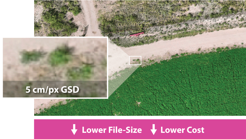
Example of a 5 cm/px GSD map
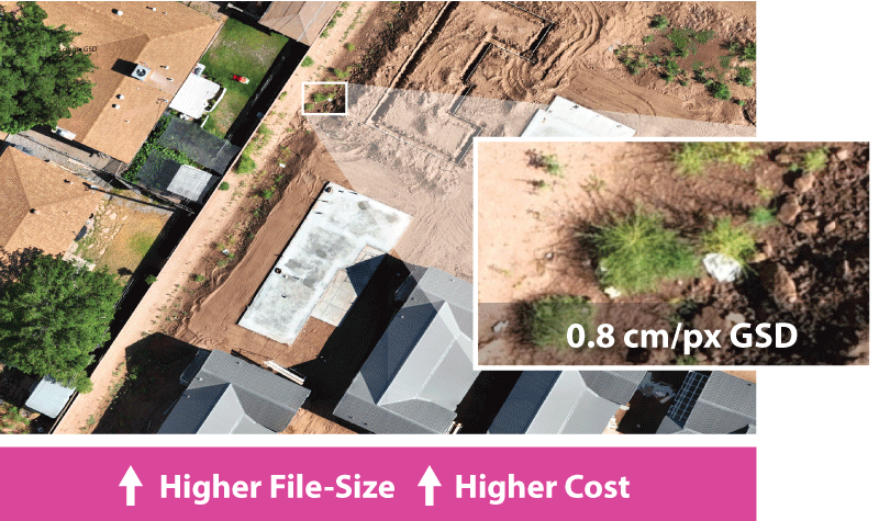
Example of a 1 cm/px GSD map
Legal and Practical Limits
By law, we can only fly up to 400 feet AGL, which limits the maximum GSD we can offer to around 5 cm/px. While it’s possible to capture images with a GSD lower than 1 cm/px, most projects don’t require that level of detail. We help guide our clients to the right balance between cost and resolution.
Need Smaller Files?
High resolution images come with massive file sizes. If you need smaller file sizes for easier handling, we can downgrade your map resolution after processing (e.g., from 5 cm/px to 10 cm/px). However, the cost will remain the same since the initial data capture and processing are done at the higher resolution.
At Stratus Imaging, we’re here to help you choose the right GSD for your project’s needs, ensuring the best balance between detail and cost. Contact us to learn more or see a demo of how GSD impacts your project.